Local information from Wanborough Parish Council.

Charitable or non-commercial groups in the
Wanborough area can promote their organisation and events
through this site. Simply send details to info@wanborough.info
Public Footpaths
Footpath Maps Here
The maps below show the extensive number of public footpaths available within our Parish.
If you find any footpath blocked or inaccessible please contact Angela Raymond, Parish Clerk who will speak to the Footpaths and Rights of Way officer at Swindon Borough Council, as they have responsibility for maintaining these.
Click on the links below to view the maps in the best quality:


Footpaths - Temporary Closures
Work on Footpath WA19 from the top of Oakapple / Stanley Close footpath to Springlines Meadow (along the back of Springlines) is due to take place to improve the walking surface for pedestrians. The closed section is indicated by points A & B.
The work will commence on Tuesday 30th May (subject to weather conditions) and take approximately 5 weeks.
While the work takes place the footpath will be closed with a diversion in place via Adams Meadow.
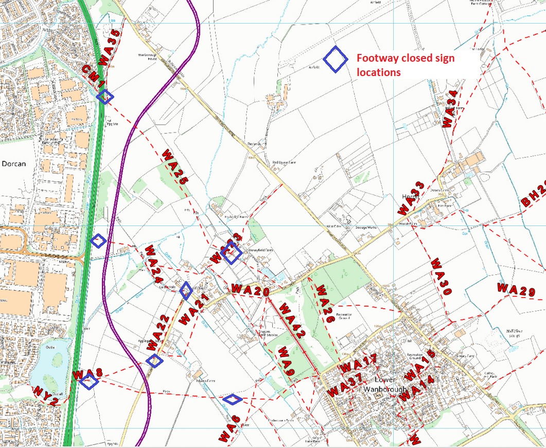
Please see notice below confirming that a number of footpaths along The Marsh are being temporarily closed while the Southern Connector Road is being constructed.
This map provides details of where these footpaths are and exactly from where they are closed.


The maps below show the extensive number of public footpaths available within our Parish.
If you find any footpath blocked or inaccessible please contact Angela Raymond, Parish Clerk who will speak to the Footpaths and Rights of Way officer at Swindon Borough Council, as they have responsibility for maintaining these.
Click on the links below to view the maps in the best quality:


